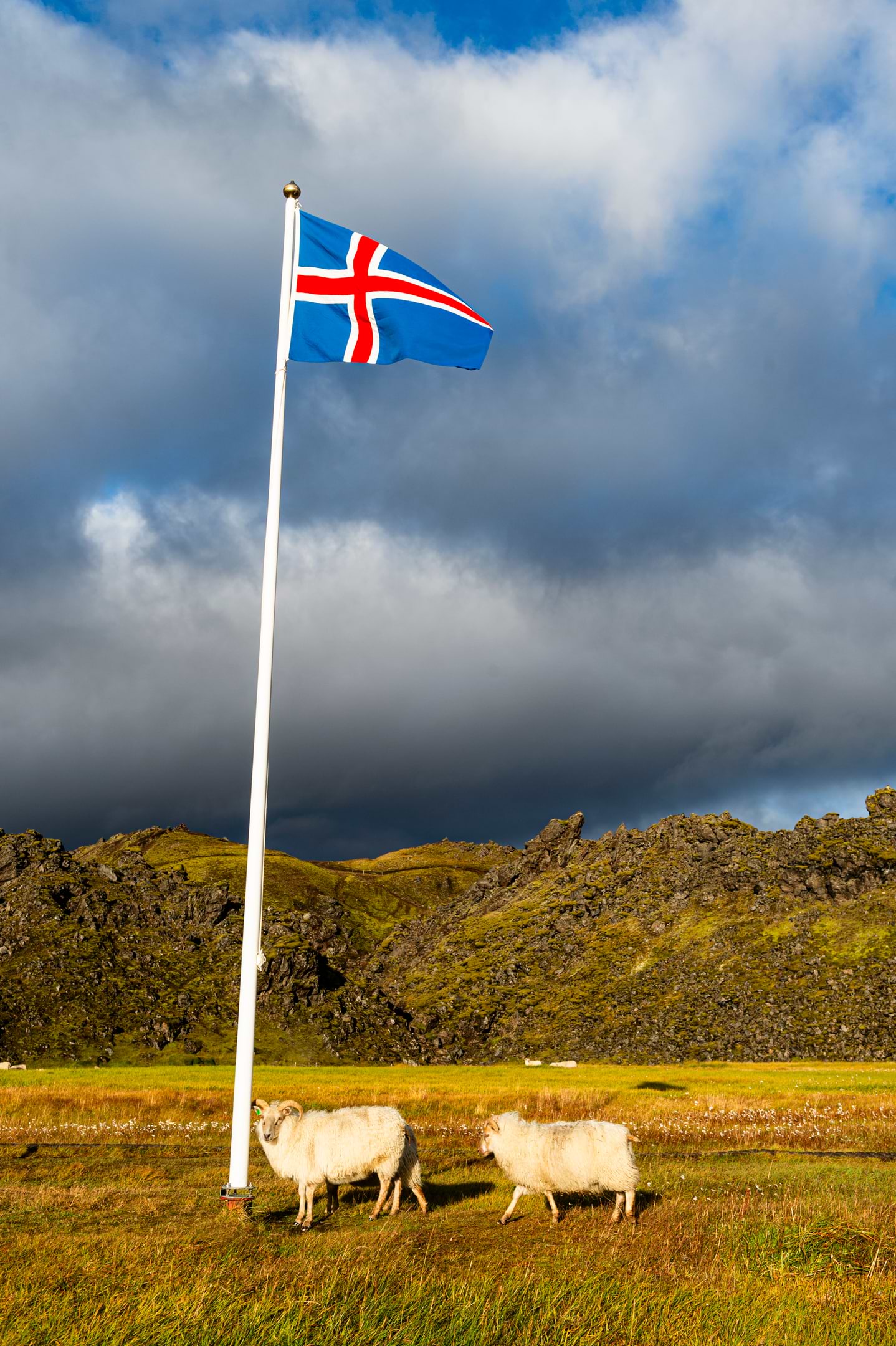
There are almost twice as many sheep as humans in Iceland.

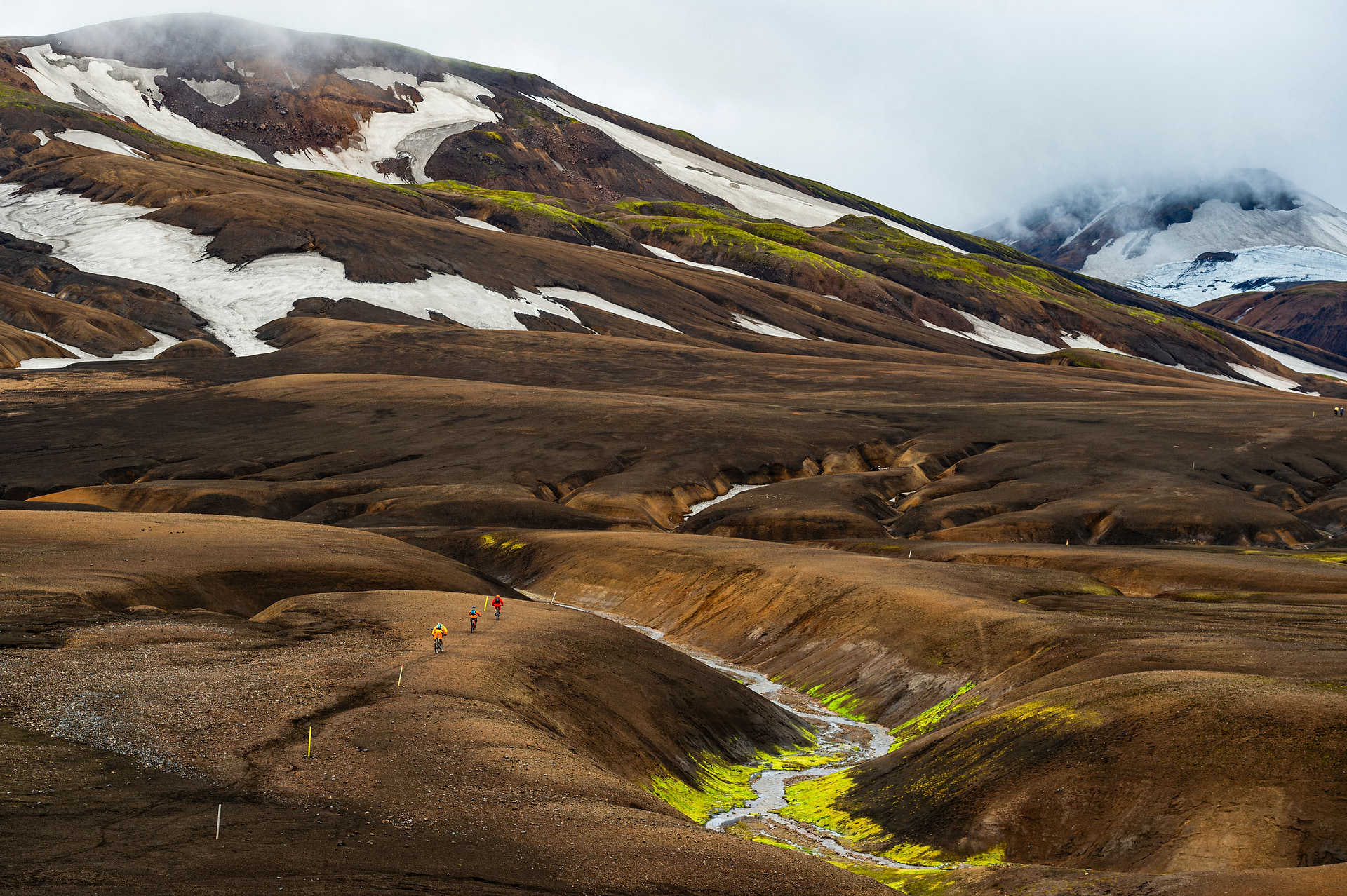
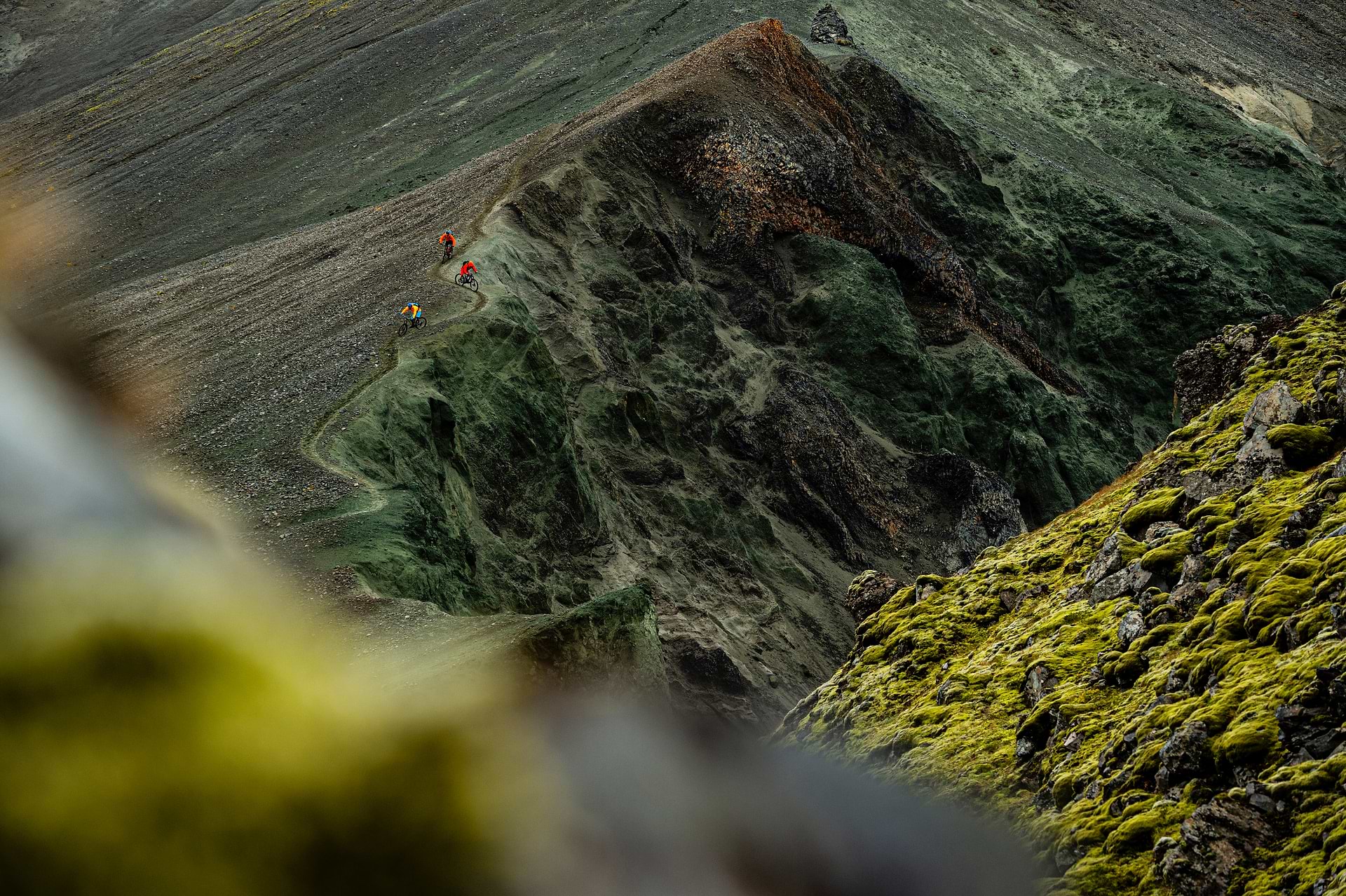
Iceland’s Laugarvegur route is like riding through a Planet Earth film. Nature’s smorgasbord spreads outward in all directions on this 55-kilometre hut-to-hut trip with countless waterfalls and canyons, stunning glaciers, rivers, multi-coloured rhyolite mountains, black volcanic rock, steaming geysers and permanent snow fields.
but not the third-world kind. Instead, it’s Type 1 fun — the ever-shifting vistas and changeable weather are the only surprises. The trails are well-built and well-marked, the huts are high-quality, and it’s incredibly safe.
There are almost twice as many sheep as humans in Iceland.
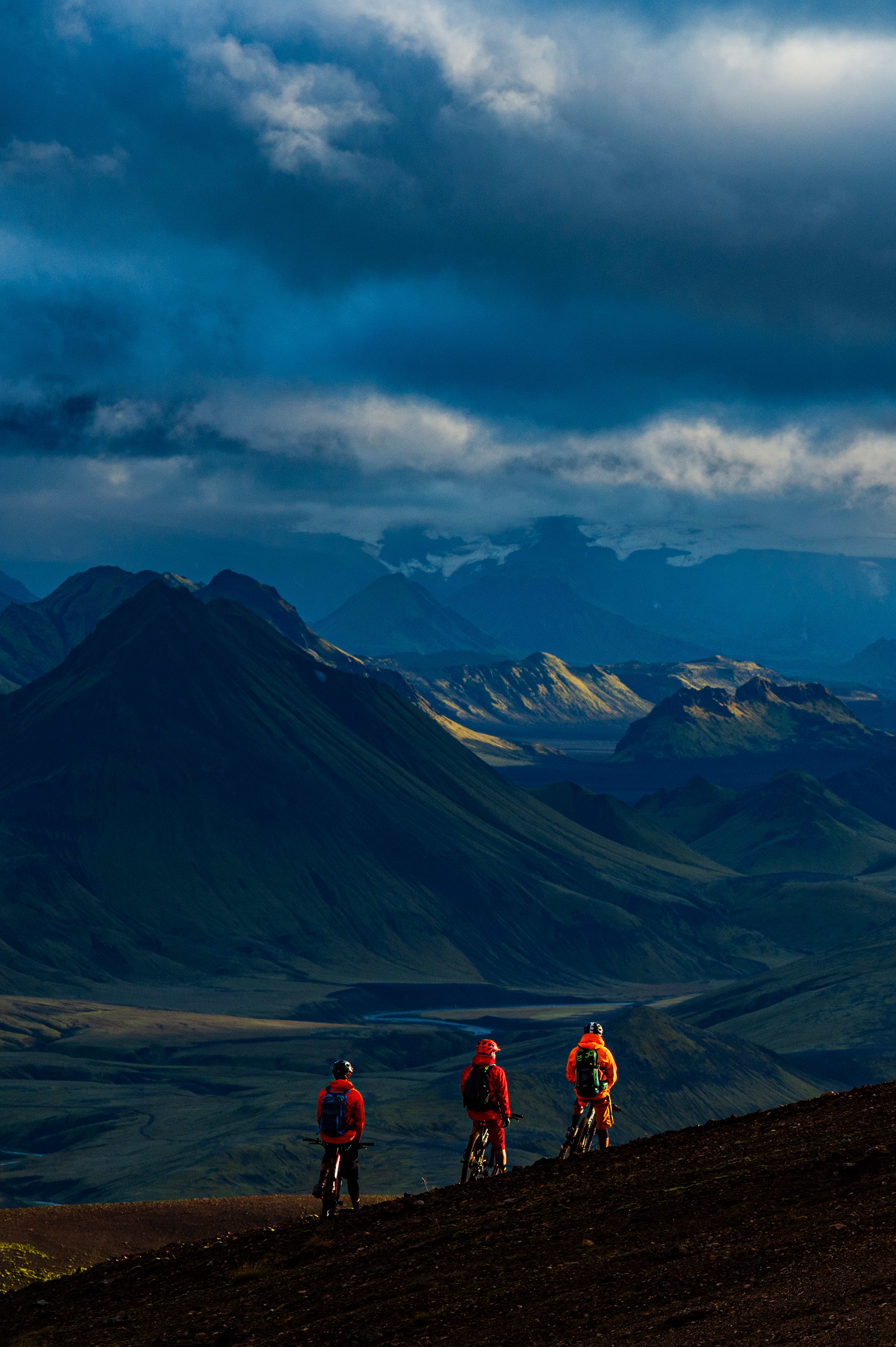
Laugarvegur crosses an almost surreal landscape of the vast Icelandic highlands.
There are almost twice as many sheep as humans in Iceland.
Laugarvegur crosses an almost surreal landscape of the vast Icelandic highlands.
a stunning confluence of trails, colorful hills, and natural hot springs. Mud pots bubble and burp, dotting a giant canvas of black silica, purple pumice, and electric-lime moss with paint-can spills of ochre, pink, gold, plum, rust, and honey. It is a mind-boggling kaleidoscope — and this is just day one.
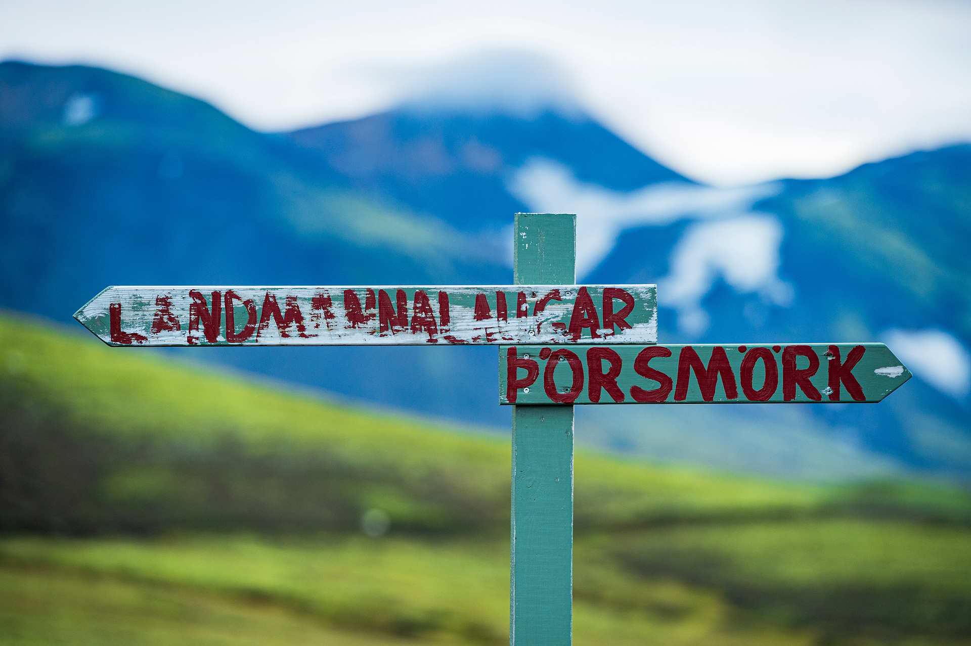
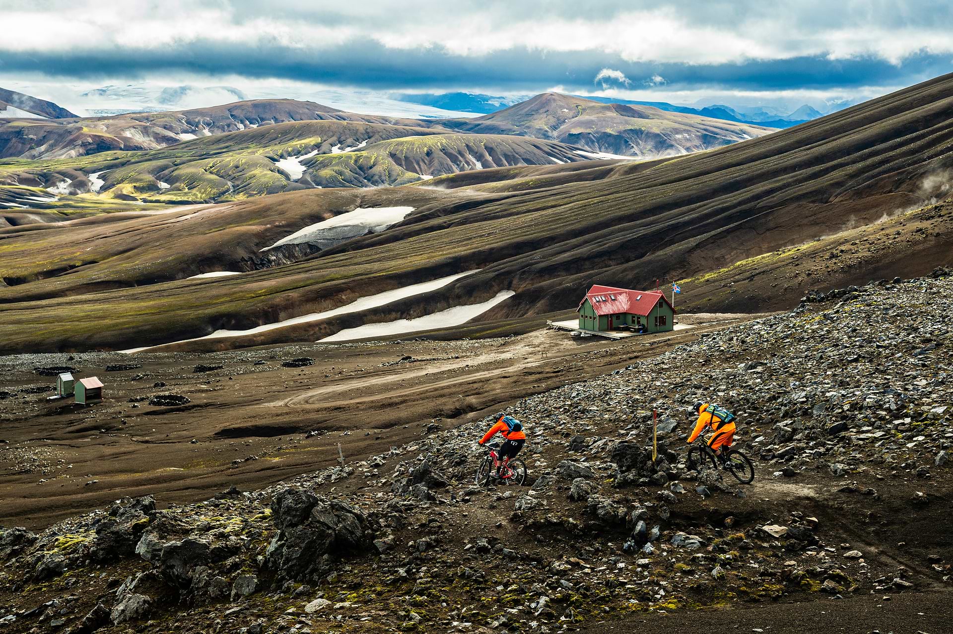
Located in the Fjallbak Nature Reserve in Iceland’s remote central Highlands, about four hours east of Reykjavik, the Laugarvegur is Iceland’s most popular hiking route, which mountain bikers have recently discovered. Linking six huts in a rugged landscape, the trail crosses one of the most active geothermal areas on the planet.
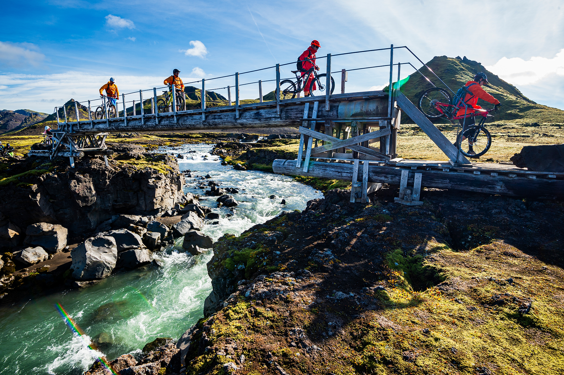
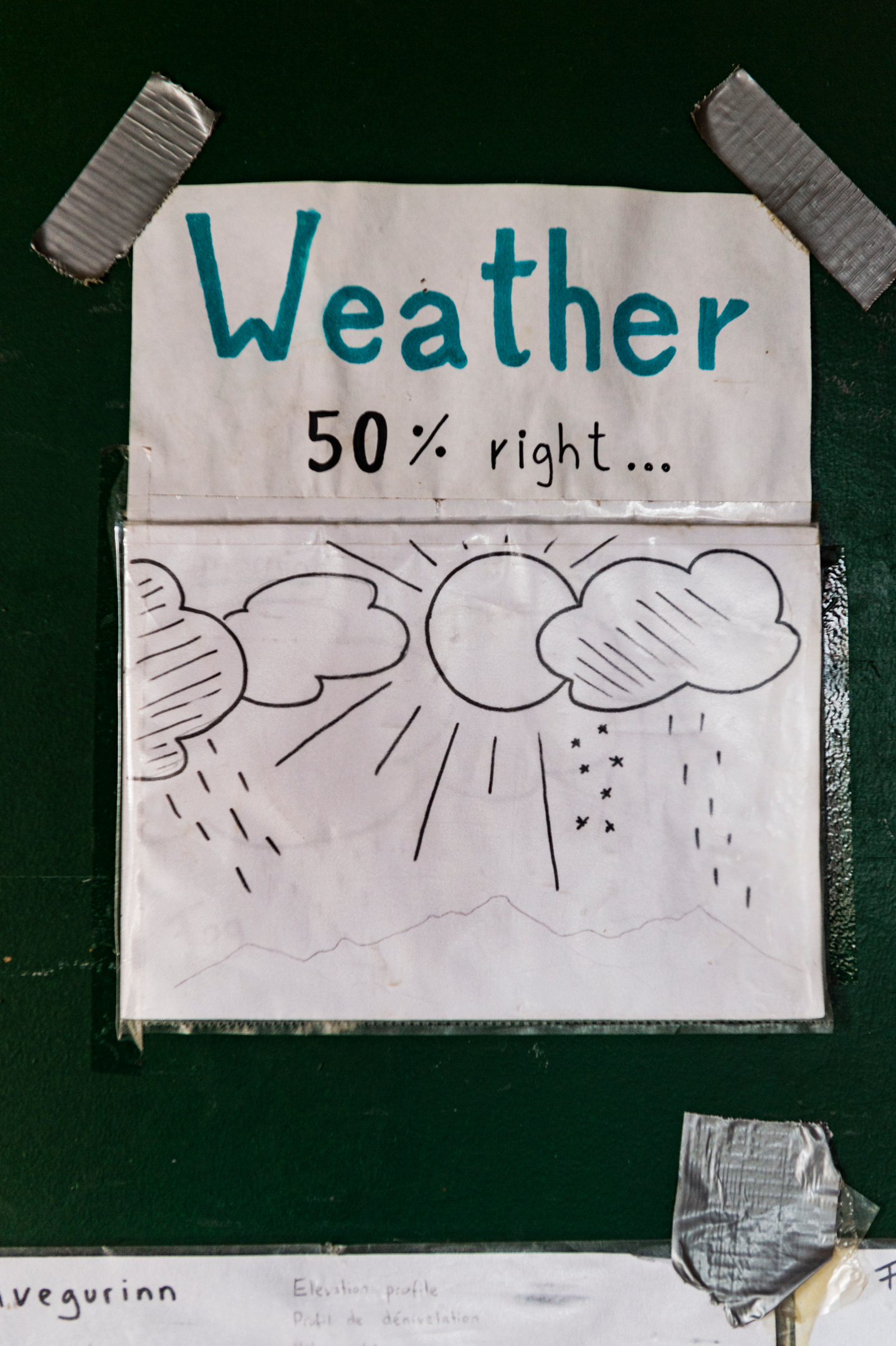
the direct route between the huts might not require a full five days of riding, so it’s easy to add detours, take photos, and enjoy leisurely lunches and afternoon coffee breaks. Mid-August is the best window for this five-day tour, but be aware that this still doesn’t guarantee anything in Iceland — pack lots of layers, puffy rain gear and warm gloves.
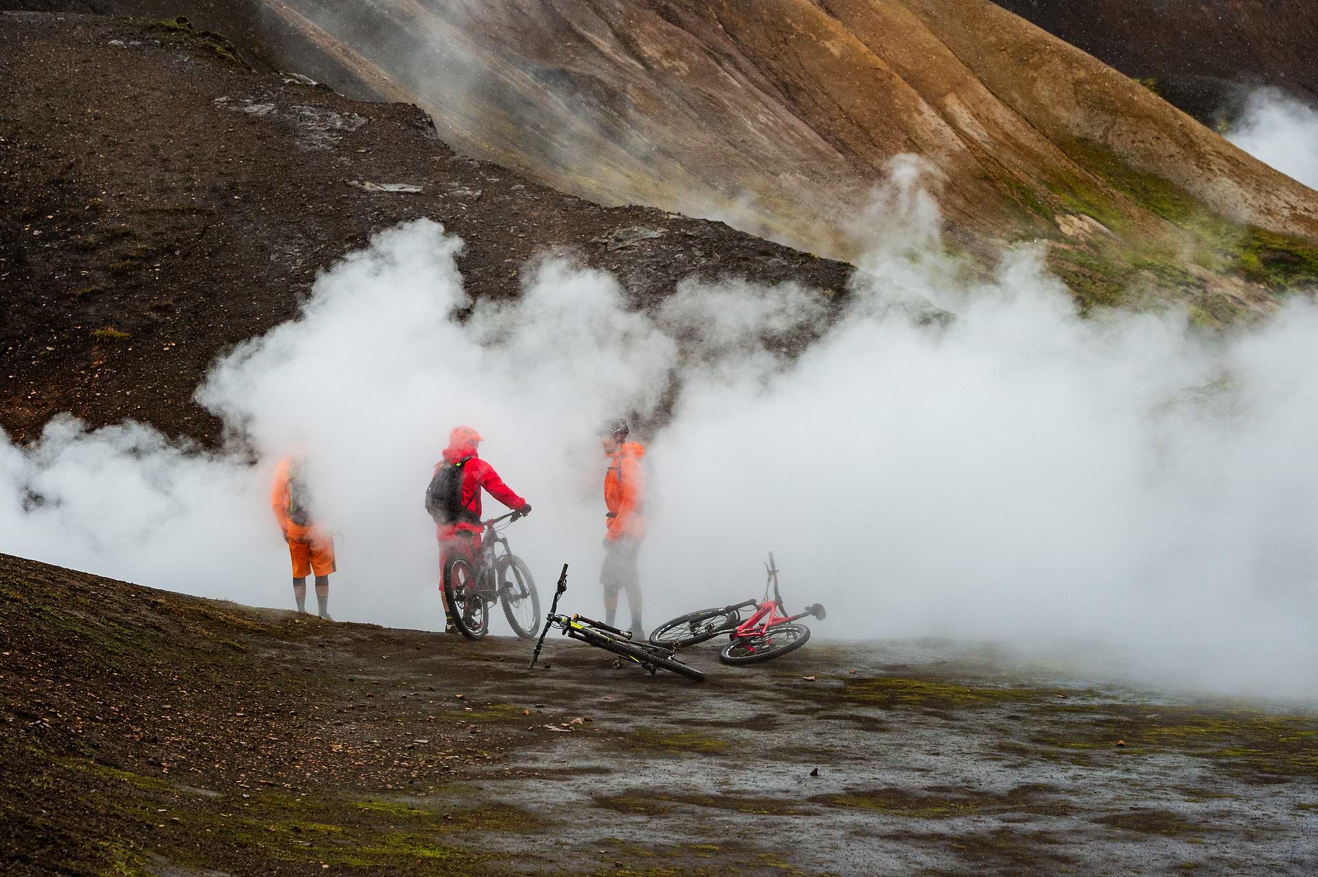
At the end of the first day, approaching the Hrafntinnusker Hut, the ground seems to smoulder, stoked by some persistent blaze beneath the surface. Steam from natural hot springs and other geothermal features rise from scores of vents – riders can disappear into a wall of steam – more like being on a stage during a rock concert than on a mountain bike ride in the remote wilderness except for the distinct smell of sulphur.
precisely what the trail does — it follows a stream. Starting in the hills of the geothermal area of Landmannalaugar, it connects to the forested valley of Thórsmörk near the south coast. Seventy-five thousand people hike this route every season, but mountain bikers are still infrequent.
Mountain biking in Iceland has yet to be specially developed despite growing and attracting more tourists. But even if Iceland lacks a vibrant bike culture and purpose-built trail networks, the overall experience of riding in this remote, multi-faceted and otherworldly country makes a visit incredibly worth it.
Iceland has about 130 volcanoes — the highest concentration globally — and many are active. Eruptions contribute almost half an inch to the island’s width annually.
Iceland has about 130 volcanoes — the highest concentration globally — and many are active. Eruptions contribute almost half an inch to the island’s width annually.
Imagine that after a windy night in the Álftavatn Hut, you cook a hearty breakfast with bacon and eggs for the crew, and even though the wind has calmed down, it’s raining outside, so you aren’t rushing out the door. You chat with a few Icelandic students who had also spent the night in the hut and share some trail beta over a second cup of coffee.
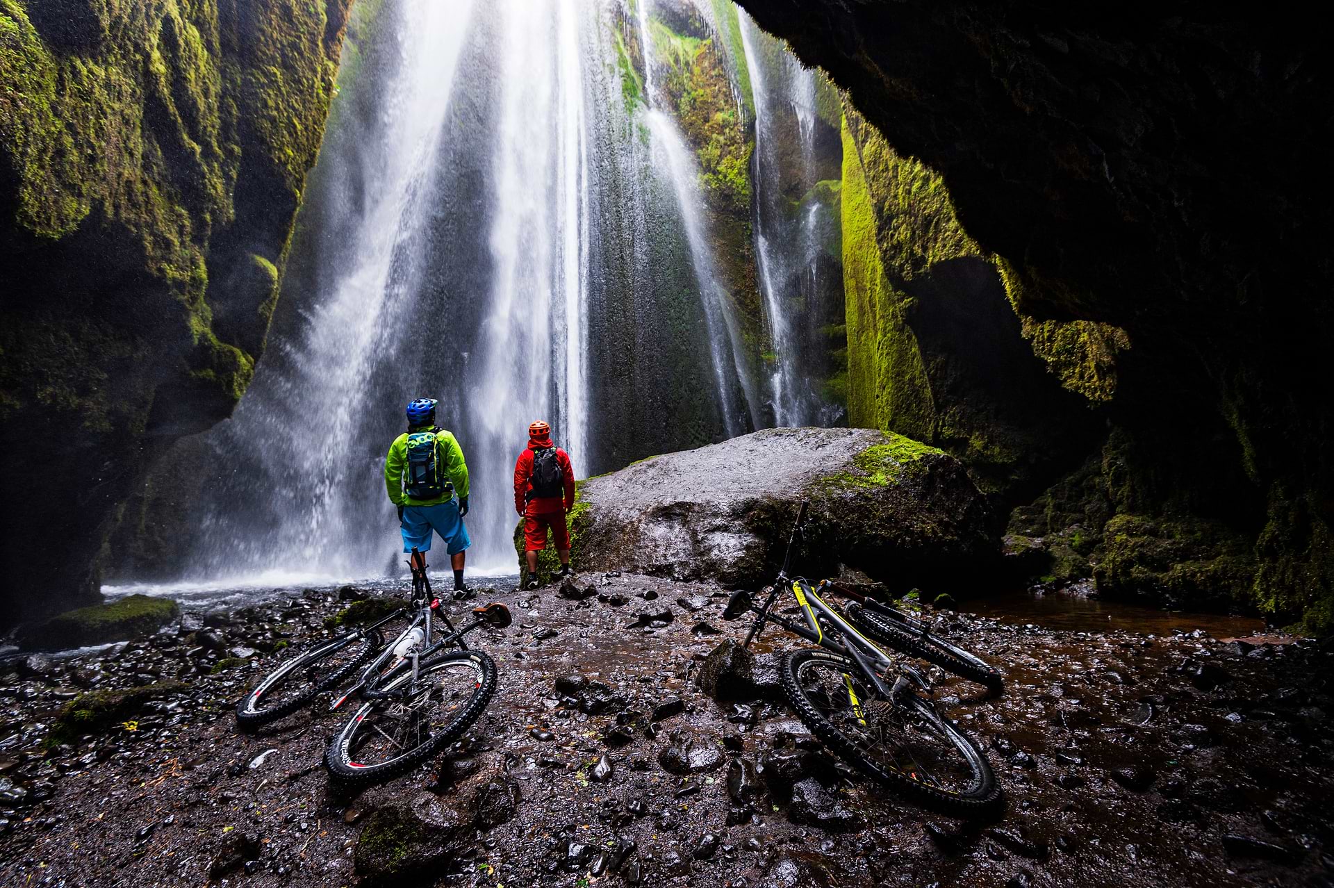
Once you venture off into the surreal landscape again, you will descend a grumbling slope about an hour later into a simultaneous destruction and creation scene. At the head of a valley thick with steam clouds, the crack-riddled, 30-meter-high snout of a glacier splits apart. Two ice caves, 15 to 20 meters tall and twice as wide, open like giant windows on the underworld, their floors littered with refrigerator-size ice blocks crashed down from above. Water drips cold from the ice caves overhead and erupts as hot steam from myriad vents below. This is Iceland – raw, ever-changing, and simply stunning.
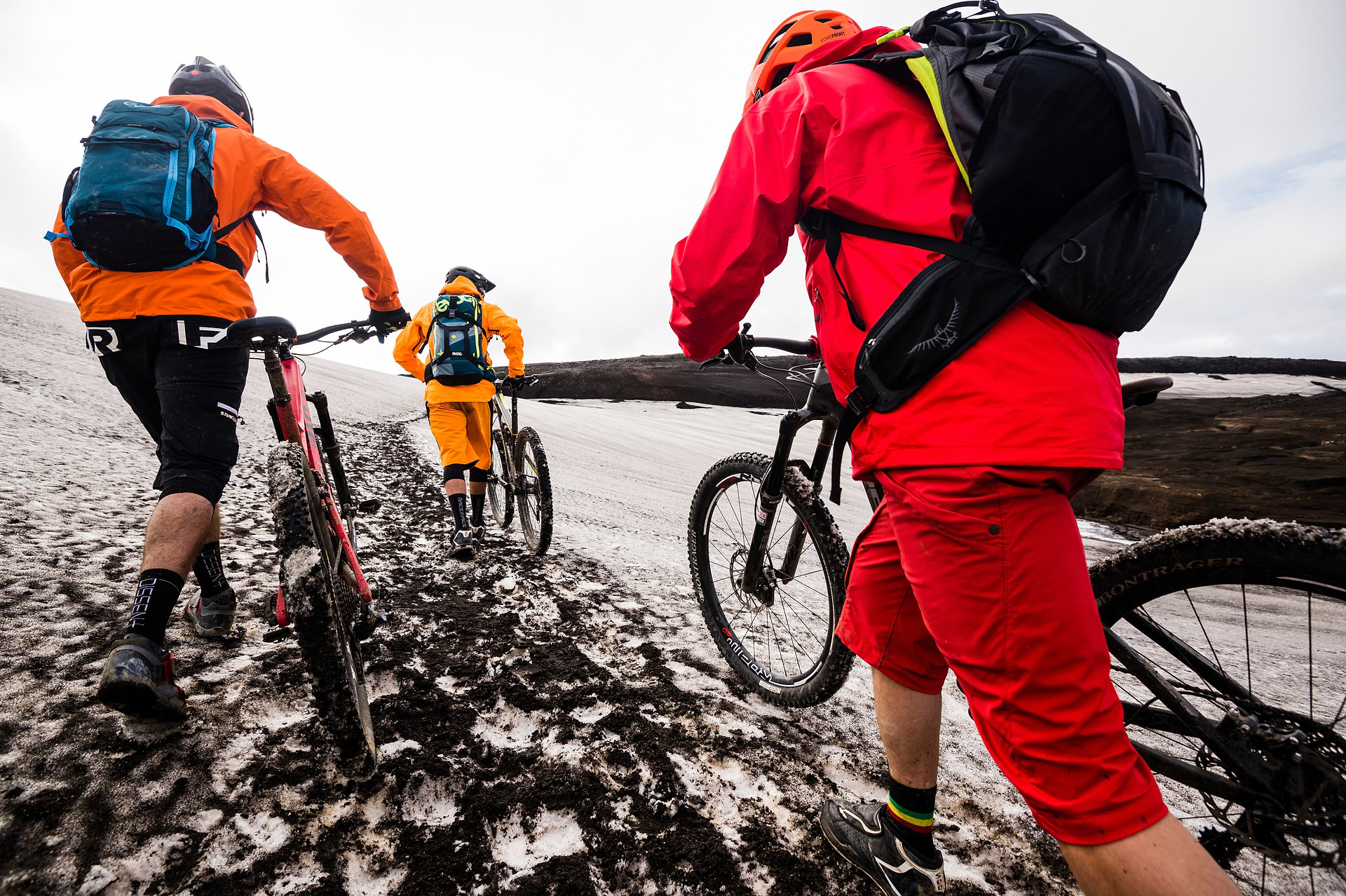
With the unpredictable and harsh weather and occasional difficulty navigating the terrain…
…the Icelandic Highlands could easily be challenging, so careful preparation is essential.
With the unpredictable and harsh weather and occasional difficulty navigating the terrain…
…the Icelandic Highlands could easily be challenging, so careful preparation is essential.
the highest concentration globally — and many are active. Eruptions add almost half an inch to the island’s width annually, producing one-third of the planet’s lava output over the past five centuries.
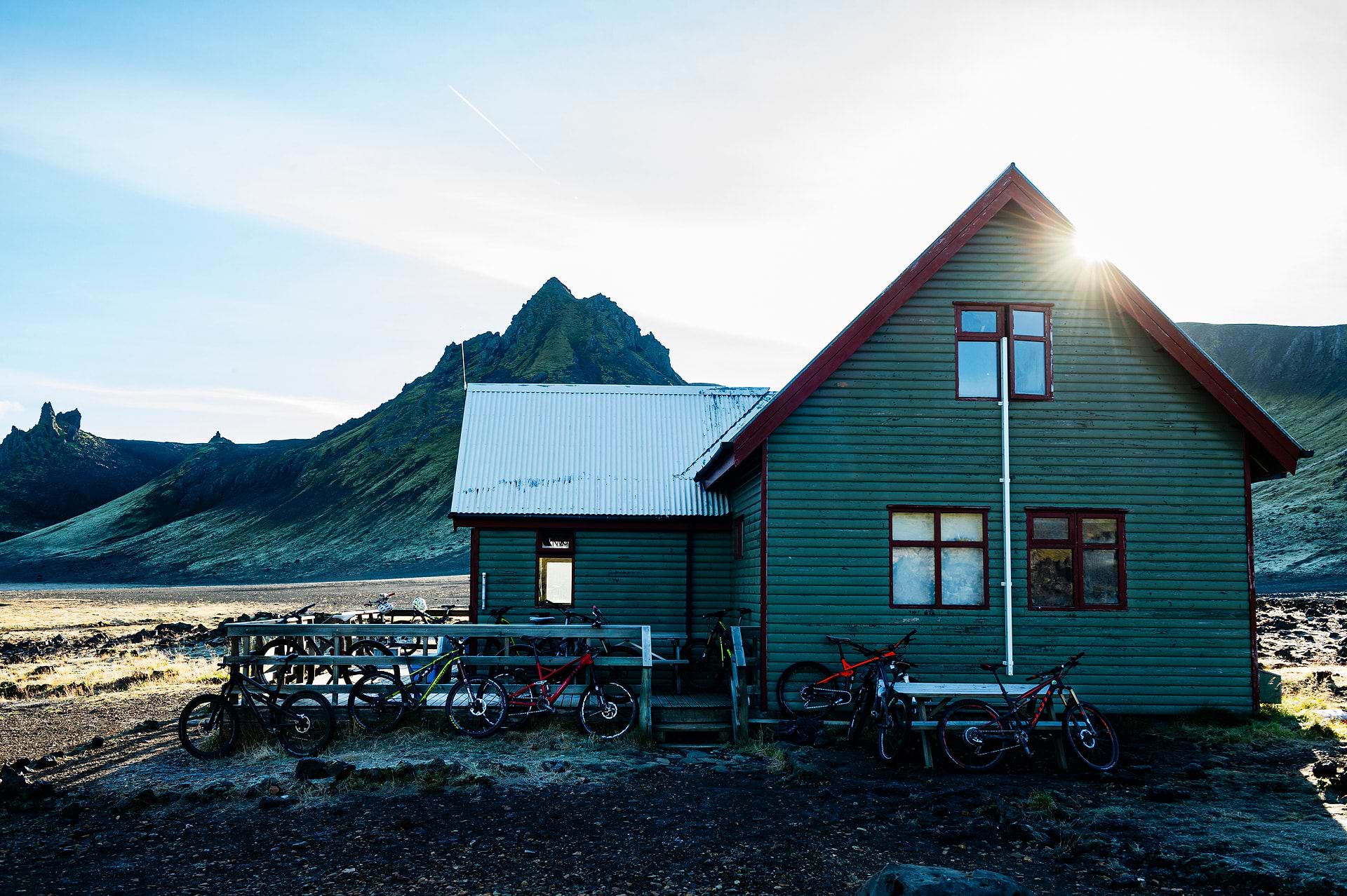
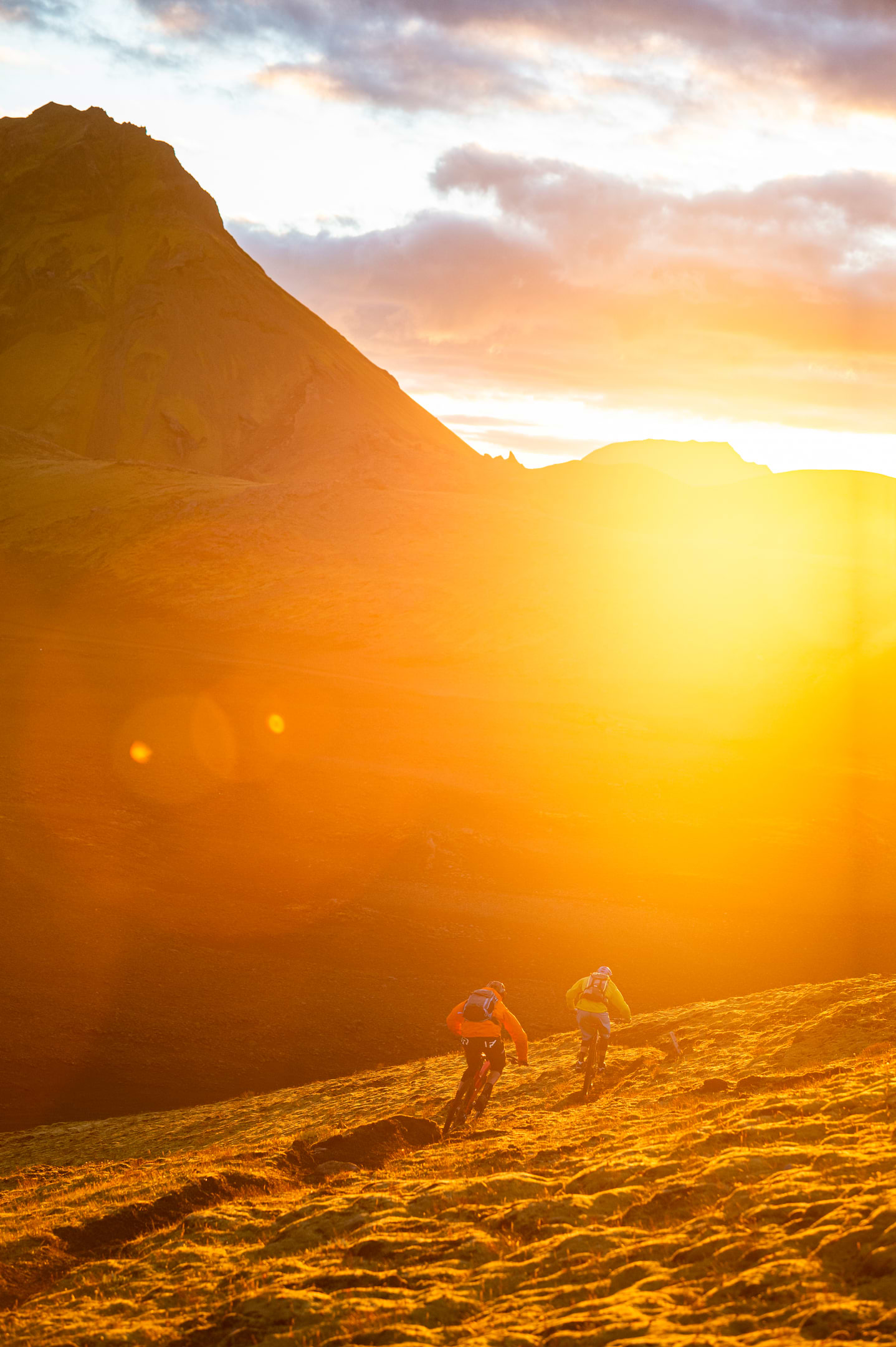
On day three or so, you will arrive at the Hvanngil Hut, well past the halfway point on the route. The ever-lasting Arctic light might motivate you to go for a ride after dinner to watch the sunset from a nearby peak. Behind the hut, you can follow a trail up and around one of the highest peaks in the area, pushing your bike the last bit. The scenery from the top is spectacular; the contrast between the green hills, the black volcanic rock, and the fiery sky is yet another mind-blowing moment to add to your memory bank.
At first glance, the Laugarvegur might not appear to be much of an adventure. The trail is relatively short, there are no massive vertical gains, and the riding isn’t technical. But the Highlands can fool even the most experienced riders. The trail traverses a raw and desolate landscape where a mistake or unforeseen incident could quickly cause a severe result. With the unpredictable and harsh weather and occasional difficulty navigating the terrain, the Icelandic Highlands could easily be challenging, so careful preparation is essential.
the landscape changes dramatically once again. You have entered the volcano zone. As you enter the Thórsmörk Nature Reserve, you’ll see Eyjafjallajökull – a volcano that erupted in 2010, blanketed the country with several inches of ash, and caused a shutdown of European airspace for several weeks. Not surprisingly, Thórsmörk gets its name from the Norse god Thor, associated with storms, lightning, thunder, strength, and trees. When you know this, the landscape in the valley suddenly makes sense — big rocks, cliffs, mountains, valleys, glaciers, massive waterfalls and, as the map indicates, a birch forest. These will be the first trees you’ve encountered on the trip so far. In a country once covered by trees but logged virtually bare, you soon understand that trees are now so rare that even a few are called a forest.
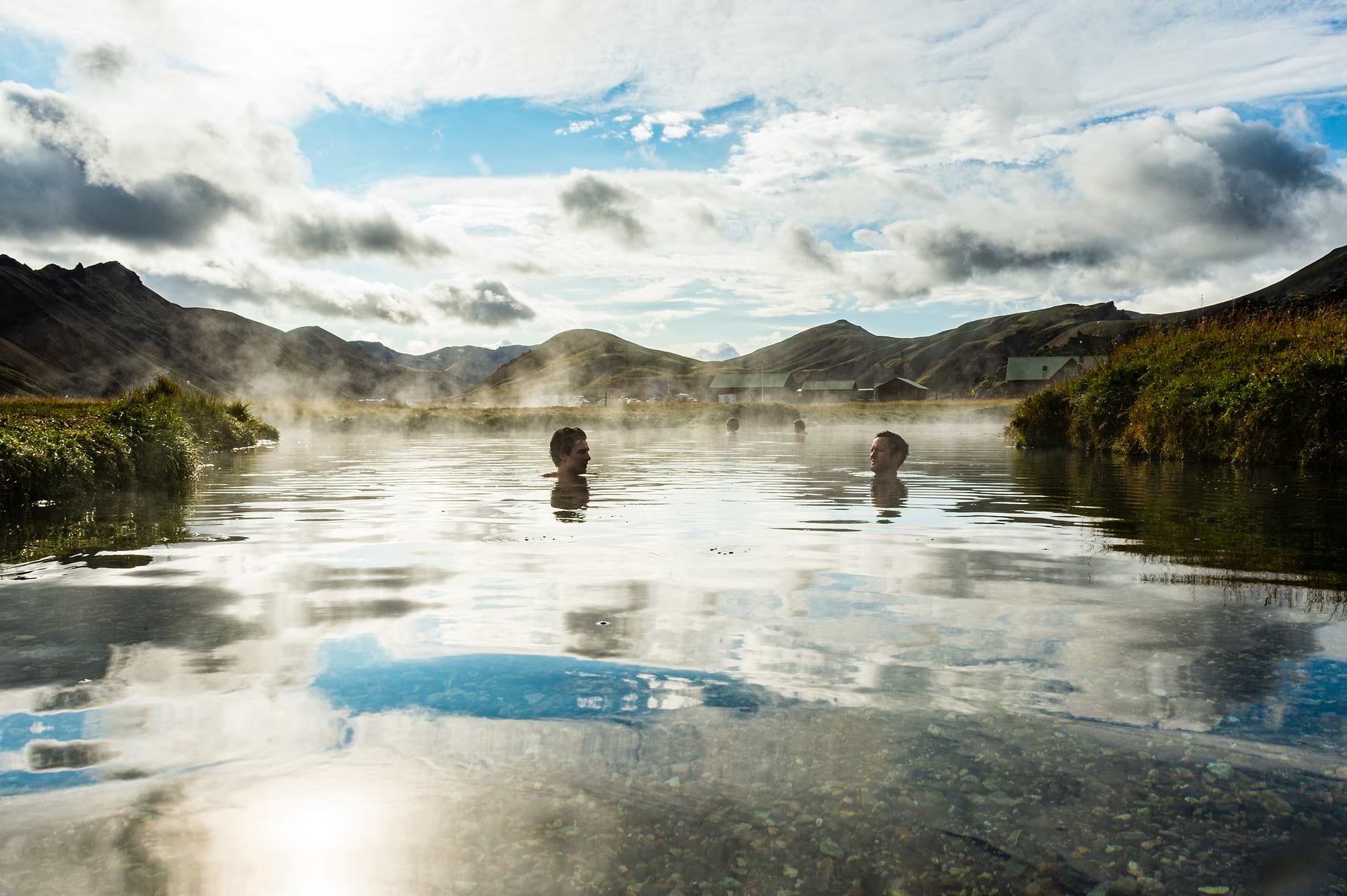
After five days of riding, you finally approach Thórsmörk and the Volcano Huts through sunshine, rain, frost, or hail. If you’re still keen for more, you can continue over the mountains, skirting the enormous glaciers, and finish your ride at the Skogafoss waterfall — an additional 30 kilometres. Or you can simply bask in the volcanic hot springs as a healing balm for sore bodies as you review the incredible journey you’ve just completed.

MATTIAS FREDRIKSSON is a photographer, journalist, and editor-in-chief for Interstellar. For almost 30 years, Fredriksson has documented ski and mountain bike cultures globally. He is a veteran adventure photographer with over 500 cover shots to his name and impressive longevity in the outdoor space. Fredriksson continues to contribute to many publications and photographs global campaigns for commercial clients. He lives in Terrace, British Columbia.
MATTIAS FREDRIKSSON is a photographer, journalist, and editor-in-chief for Interstellar. For almost 30 years, Fredriksson has documented ski and mountain bike cultures globally. He is a veteran adventure photographer with over 500 cover shots to his name and impressive longevity in the outdoor space. Fredriksson continues to contribute to many publications and photographs global campaigns for commercial clients. He lives in Terrace, British Columbia.
RELATED STORIES


